Hit the Trails
Hiking around the Bozone.
Next time you get a chance—a quiet moment under the big, blue Montana sky—take a second to look around. What do you see? First, you’ll probably notice the Bridger Range, cradling our town from the northeast. To the south, the Gallatin Range extends far back into the skyline. Southwest, the Spanish Peaks poke up, keeping the Madison Range out of view and ready to be uncovered. Due west and farther out, oftentimes fading into the horizon on hazier days, the Tobacco Roots loom in the distance. The Absarokas sit just out of view to the east, with no shortage of stones to turn.
There are more ranges to see, of course, depending on one’s particular perch. But the point is, there are foothills, peaks, canyons, and valleys in every direction. Nearly every summit can be climbed; every drainage holds a secret. Even the foothills and woods near town abound with opportunity—the amount of adventures and experiences you can have is limited only by your desire to peek around that next bend. The best part? Trails wind their way through it all, beckoning you to come forth and explore. If you need some advice to get started, here are a few classic outings.
Around Town
Gallagator: Named after an old railway line, this trail acts like an arterial pipeline through Bozeman. It’s a popular commuter path from the north to the south end of town. On it, you’ll stroll by gardens, climbing boulders, and plenty of jumping-off points onto other local trails.
East Gallatin Recreation Area: North of town, you’ll find this local hotspot. Despite its close proximity and popularity, there is plenty to do here. Get in on the action at East Gallatin Pond (“Bozeman Beach” to the locals) or duck back into a trail system hidden among the river and trees. It, too, ties into other trails, including the path to the M.
Highland Glen Nature Preserve: This small network is another great close-to-town option. Here you’ll enjoy rolling hills, forested gulches, great views of the surrounding mountains above the lush vegetation, and the occasional company of grazing cattle.
Headin’ Up
Triple Tree: A local favorite in the foothills of the Gallatin Range. Get there using one of the nearby parking areas, or hike in from Painted Hills if you want to add some extra mileage. Otherwise, you’ll be getting about four miles of pleasant, forested trail with a great overlook back north over the valley. Be aware of mountain bikers on this trail, typically riding the loop counterclockwise.
The M: Montanans sure do love putting letters on their mountains. While some denote the town below or name of the mountain, our M is dedicated to Montana State University and goes back all the way to 1915. There are two ways to get up to the M. The standard route switchbacks along the foothills, while the steep route cuts straight up the face of the mountain. There’s a reason this hike is so popular: the view across town and the valley beyond is fantastic.
Drinking Horse: This mountain got its name because it resembles a horse taking a drink from a creek, when gazed upon from the east. The trail is another favorite of folks looking to get out for a jaunt close by, any time of year. In fact, the trail averages about 150 daily users in the winter and a whopping 500 in the summer. You may not get much solitude here, but the views toward the Bangtails and back into Bridger Canyon are remarkable.
Top Notch
Chestnut Mountain: A great summit option without having to go very far. You’ll find the trailhead just inside the mouth of the Bozeman Pass, on the way to Livingston—take the Trail Creek exit. Climb up a nicely buffed-out trail that switchbacks through forest and meadows until you’re finally rewarded with incredible views of the Absarokas and Paradise Valley.
Sacajawea Peak: One of the best bangs for your buck in the Bridgers (with Baldy a close second). Starting at Fairy Lake, this trail is only about four miles round-trip, but you’ll surely feel the elevation as you climb 2,000 vertical feet to the summit. At the top, you’ll get 360-degree views, including all the aforementioned ranges. The resident mountain goats have it good.
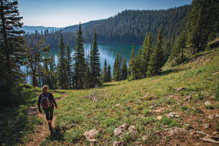
Mt. Blackmore: This mountain has a prominent presence over the valley, constantly peering down on us from the top of the Gallatin Range. Just take a gander south and you’ll be able to make out its pyramid shape. Because of its physical and historical significance to the area, it’s well worth checking out up-close and personal. From the lower trailhead, four miles round-trip will get you to Blackmore Lake, and 12 will take you all the way to the summit and back.
Etiquette
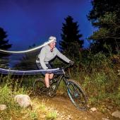
Most of the above trails are shared with bikers—even some of the more challenging ones, like Blackmore. Generally, bikers should yield to hikers, and both should yield to horses. Downhill traffic should also yield to those coming uphill. However, this is only a rough guideline, and a more nuanced approach should be taken. Just be kind, courteous, and keep your head up—everything should work out fine. It’s often much easier for a hiker or runner to take a step off the trail and allow fast-moving bikes to pass than it is to insist otherwise.

