Proven Gilty
Hiking Golden Trout Lakes.
Before the snows of winter envelop the high country, take an opportunity to explore the best of the Gallatin Range, Golden Trout Lakes. Instead of hiking to Lava or Storm Castle like you always do, push a little further down the canyon to this gem. You won’t regret the extra effort.
Vitals
Hiking distance: 5 miles
Hiking time: 3 hours
Elevation gain: 1,000 feet
Maps: USGS Hidden Lake and Lone Indian Peak; Beartooth Publishing: Bozeman, Big Sky, West Yellowstone
Hike Summary
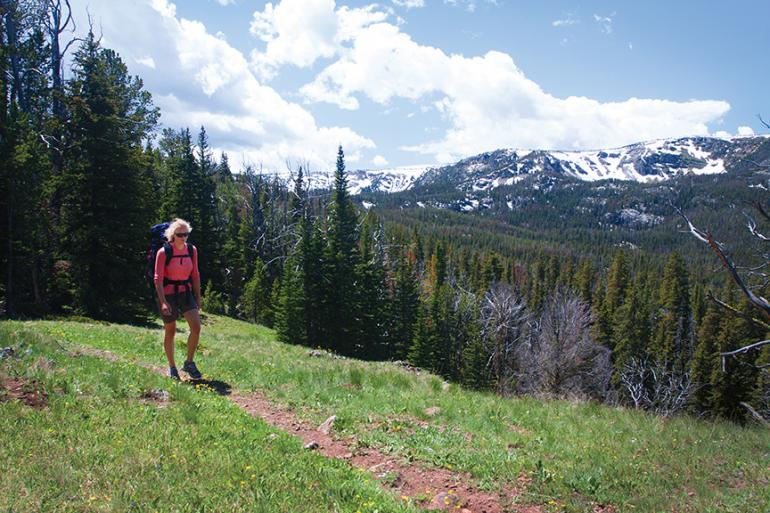
The Golden Trout Lakes sit in a basin at an elevation of 9,050 feet. The high-mountain lakes rest in a cirque on the northern slope of Eaglehead Mountain, a three-peaked mountain with a rounded, grassy ridge. The largest of the Golden Trout Lakes is surrounded by forest, with good campsites above the north and east shores. A couple of smaller lakes can be found above and to the west. The Golden Trout Lakes trail climbs through a series of flower-filled meadows and a mixed forest of pine, spruce, and fir to the scenic lakes.
Driving Directions
From Four Corners nine miles west of Bozeman, take Hwy. 1 91 south toward Gallatin Canyon. Drive 28.6 miles to Portal Creek Rd. on the left between mile markers 54 and 53. Turn left and wind 3.8 miles up the canyon to a clearly marked Y-fork. Veer to the left and continue three bumpy miles to the Upper Portal trailhead parking area at the end of the public road. From the Big Sky turnoff, drive 5.2 miles north on Hwy. 1 91 to Portal Creek Rd. on the right.
Hiking Directions
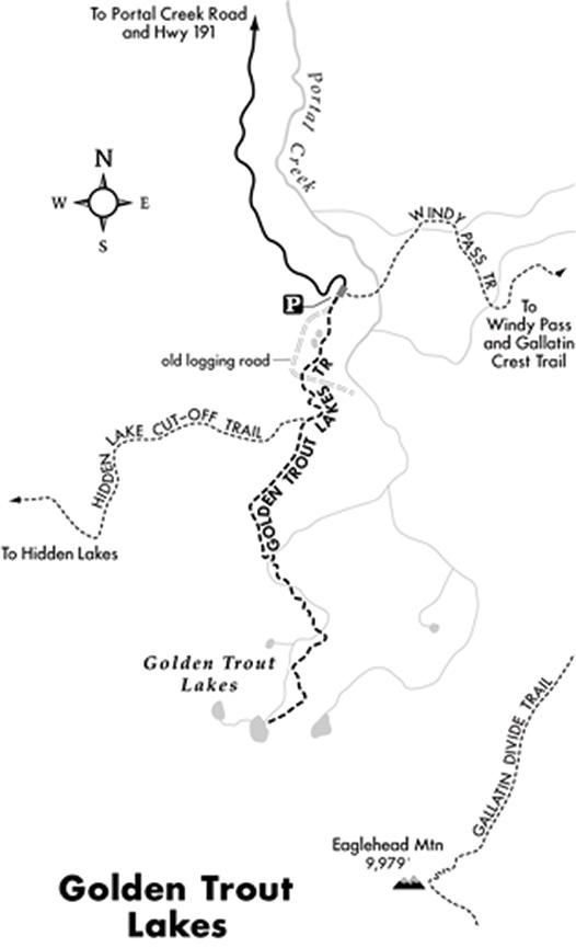
Walk 20 yards past the parking area on the dirt road to the sign on the left for the Golden Trout Lakes. Veer left and head up the slope into a mixed forest of lodgepole pine, Engelmann spruce, and subalpine fir. Pass two ponds on the right, and climb the west canyon wall, overlooking the forested drainage. Cross an abandoned logging road at .6 miles. Zip up three switchbacks to a posted junction with the Hidden Lakes Cut-off trail, which leads two miles west to the Hidden Lakes. Stay to the left and continue south, meandering through a series of sloping meadows. Descend to a cascading stream, which drains the Golden Lakes, then climb a fairly steep grade up the north slope. As the path mercifully levels out, cross the outlet stream again. Pass through a meadow containing a large bog. Begin the last, steep climb along a rock-embedded path amid huge boulders. At 2.5 miles, emerge at the northeast shore of the largest of the Golden Trout Lakes. The lakes sit beneath the north flank of Eaglehead Mountain, rising 800 feet above the lake in a towering cirque.
This article is excerpted from Robert Stone’s Day Hikes around Bozeman, Montana. For more info, visit dayhikebooks.com.

