It's A Long Way To The Top
Three local traverses to hit this summer.
Living in Montana, we are spoiled by the number of choices we have when it comes to climbing mountains. One way to "re-appreciate" the bounty in the surrounding peaks is to add different approaches or extend climbs into longer traverses. Sure, tagging a summit and dashing back to the trailhead is a great way to push your limits, but I have to ask, why be in such hurry to get out of the mountains? With a traverse, you increase the adventure quotient and will discover new ground on what you thought was familiar terrain.
Three local peaks will show you just what I mean.

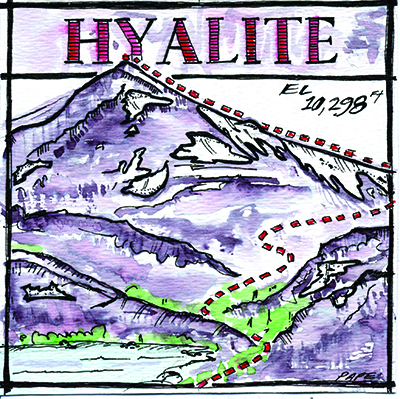
Hyalite Peak
10,298 Feet
Northern Gallatin Range
12.8 Miles Round Trip
Total Elevation Gain: 3,340
USGS Topo Map: Fridley Peak
Located at the head of the Hyalite canyon, this peak is a favorite for endurance junkies as well as wildflower fanatics and is a good introduction to the area. I love to do this hike after work on a clear summer evening when the moon is near full. The sunset is amazing and the moonlit hike past several waterfalls is surreal.
Access the trailhead by following the road past the Hyalite Reservoir to the West Fork of Hyalite Creek. The trail ascends gradually at first and passes numerous waterfalls. Once the trail starts to switchback and climb more steeply, you are nearing Hyalite Lake. The lake is great place to stash any extra gear and scope out the rest of the route. Follow the trail around the west side of the lake, crossing small runoff trickles and the occasional snow patch. The first goal is to reach the saddle at the south end of the basin. If you go early in the season, expect the trail to be hidden by snow. Be careful here as I have seen unsuspecting hikers slide down the entire length of the snowfield and crash into the rocks at the bottom. Knowing how to use an ice axe would be very useful here. Late in the summer, the trail is easy to follow.
Once you reach the saddle, turn left and grind up the final 350 feet to the summit. If your timing is just right, you will see an astonishing display of wildflowers extending from the lake all the way to the summit. At the top, take in giant gulps of the Absaroka Range to the east and scan to the southwest for glimpses of the trail as it makes its way toward Windy Pass. To make this a longer challenge, have a group of friends start from Windy Pass and swap car keys with them somewhere in the middle. Many hikers get a little smug after completing this traverse, known as the Devil's Backbone or Gallatin Crest, but every year trail runners go to Windy Pass and back in a day. Burly!

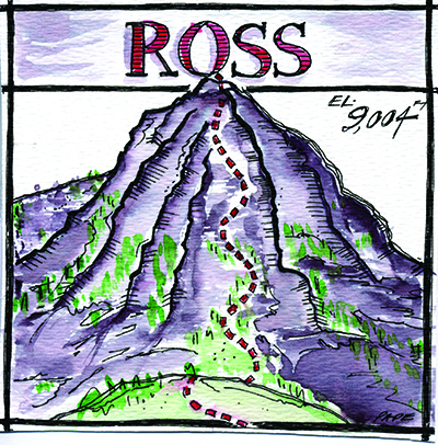
Ross Peak
Bridger Range, 9,003 Feet
12 Miles Round Trip
Total Elevation Gain: 3,165
USGS Topo Maps: Sacajawea Peak
If you have spent any time around the Bridger Range, surely you have noticed the many facades of this craggy peak, resembling the Italian Dolomites. A longtime favorite of local ski mountaineers, Ross Peak is a notch up in difficulty and has great potential for extended traverses. I also like to make this a multisport day and use a mountain bike as my approach tool. Access to this peak has changed recently, so check with the Gallatin National Forest regarding seasonal road closures and the new approach up the south fork of Brackett Creek.
Start from the parking lot at the intersection of highway 86 and Brackett Creek Road. Pedal up the south fork of Brackett Creek and stay right at the major intersections. It�s a granny-gear grind to Ross Pass, but the descent is a blast and you will be sipping your post-climb PBRs in a fraction of the time.
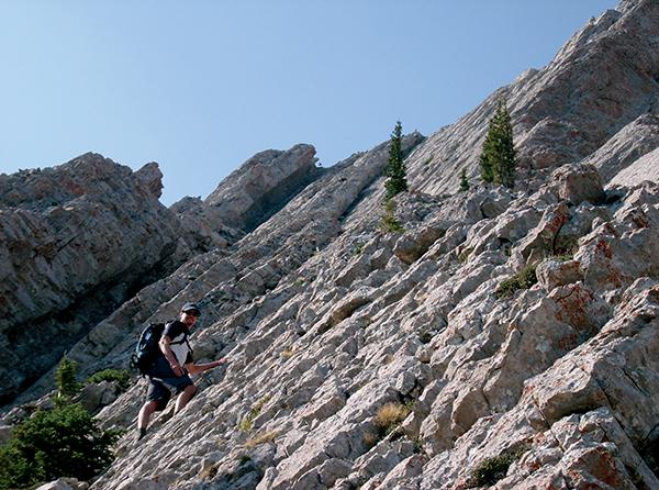
From the pass, hike north on a faint path that rises to meet the south side of Ross Peak. Follow the mountain-goat trails as they angle up and right toward a narrow gap between limestone buttresses. Keeping to the (mostly) solid walls of the gully will provide a bit more exposure and help you avoid the interminable scree. Just keep following the goat paths up and around any obstacles. At the top of the gully, stay right to reach a sparsely wooded ridge and follow its craggy top toward the high point. Cross several false summits until the true summit is visible across a deep notch. Drop down and left, cross the head of very loose chute, and scramble the last short section to the top.
To descend, you can retrace your steps, but an alternative descent avoids most of the loose scree you climbed up and provides a route-finding challenge. On the way up you should have noticed a grassy ramp that faces east. Descend this until it forks, and stay right. Head down the steepening slope until it pinches off and enters the trees. Contour to the right, crossing a few steep gullies until you reach the grassy slopes just below Ross Pass. Grab the mountain bike and bomb down the road back to your car.

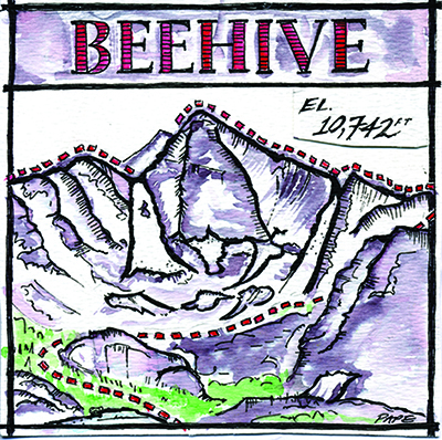
Beehive Peak Traverse
10,742 Feet
Madison Range
6 Miles Round Trip
Total Elevation Gain 2,877
USGS Topo Maps: Lone Peak
If you're looking for a beefier day in the hills, the Beehive Basin and peak traverse will give you the feeling of being on a summit all day while covering an array of alpine terrain. It also provides amazing views of the surrounding Lee Metcalf Wilderness. This outing requires solid route-finding skills to keep it under fifth class and ropeless. The exposure is serious, so do not hesitate to get out that rope if you start to feel gripped.
To start, head for the very N/NE corner of Beehive Basin by hiking up steep grass-covered slopes to a col with an awesome view of Summit Lake and Gallatin Peak. Next, hike over the bump to the west and scramble your way toward the east ridge of Beehive Peak. This is the jagged ridge with a very deep notch on your right. If you are comfortable soloing easy fifth-class terrain, you won�t need a rope, but the amount of exposure will demand your full attention. Generally, you can bypass the harder sections by picking your way around to the north, then regaining the ridge. The stellar views of Beehive and Spanish Lakes on this side make this the best part of the route. After regaining the crest, some exposed boulder hopping and a difficult move here and there, you will find yourself on the summit.
Once on top, drop down the back side and look for a steep, very loose gully that will deposit you behind the obvious south/southeast snow couloir. If weather is threatening, you could descend here and head back to the trail. But, the goal is to continue on and circumnavigate the whole basin. To do this, climb out of the notch along the ridge crest, working over and around small gendarmes. The farther you traverse the easier the terrain becomes. Keep an eye out for the many mountain goats! When the ridge becomes choked with trees, drop back to the main basin and take the trail back to the car.


