Wild Montana
MWA reveals new online trail guide.
Looking to hit the trail? Look no further than hikewildmontana.org, the Montana Wilderness Association’s new online trail guide. Built by more than 70 volunteers, the site includes descriptions, photos, and maps for 225 trails throughout Montana. Plus, it includes recommendations to satisfy your trail cravings: burgers, milkshakes, pie, and more. Whether you’re in the mood for spring wildflowers, ancient cedar forests, glassy lakes, or mountaintop vistas, you’ll find what you’re looking for. Here are a few suggestions to get started.
Teepee Creek Trail #39
Location: Gallatin Range, Custer-Gallatin National Forest
Roundtrip Distance: 6 mi.
Total Elevation Gain: 925 ft.
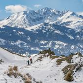
Just north of Yellowstone National Park, Teepee Creek offers views of the wild Gallatin Range. The trail gently climbs through vast acres of open meadows that offer unlimited views.
Louise Lake National Recreation Trail #168
Location: Tobacco Root Mountains, Beaverhead-Deerlodge National Forest
Roundtrip Distance: 7.4 mi.
Total Elevation Gain: 1,325 ft.
The most challenging part of this hike may be navigating the bumpy road to the trailhead (high clearance recommended). From there, enjoy a fantastic day hike to a high alpine lake cradled among 10,000 foot peaks. And, on a hot summer day, there’s even plenty of shade along the way.
Sawtooth Lake Trail #1195
Location: East Pioneers Proposed Wilderness, Beaverhead-Deerlodge National Forest
Roundtrip Distance: 7.4 mi.
Total Elevation Gain: 1,436 ft.
Not only is this a beautiful hike into the East Pioneers, but it’s a great excuse for a scenic drive through the Big Hole Valley. This dayhike follows Clark Creek, passing through lush wildflower-filled meadows before arriving at a scenic alpine lake surrounded by rocky peaks.
Gallatin Crest Trail
One-Way Distance: 48 mi.
Land Management, Custer-Gallatin National Forest
This 48-mile thru-trail brings hikers to the top of the world. Follow the crest of the wild Gallatins from Hyalite Peak to the northern border of Yellowstone National Park, traversing the heart of the Hyalite–Porcupine–Buffalo Horn Wilderness Study Area. Largely following the divide between the Gallatin River and Yellowstone River basins, the route rewards hikers with stunning views and wildflower-filled meadows nearly the entire way.
History Rock to Fox Meadow
Roundtrip Distance: 6.2 mi.
Total Elevation Gain: 1,555 ft.
Land Management: Hyalite-Porcupine-Buffalo Horn Wilderness Study Area, Custer-Gallatin National Forest
This gem is a short drive from downtown Bozeman, but offers spectacular glimpses into the Hyalite–Porcupine–Buffalo Horn Wilderness Study Area. Most hikers just go one mile to History Rock, an area where early pioneers carved their initials (don’t leave your own!), but sweet rewards await those who continue up the handful of switchbacks to Fox Meadow. From there, enjoy vast views to Mt. Blackmore and into the Wilderness Study Area.
For more details on each of these hikes, plus another couple hundred trail descriptions, visit hikewildmontana.org.
Kassia Randzio is the community engagement manager at the Montana Wilderness Association.


