
Ski Tour: Mount Blackmore


Blackmore Lake Trailhead


Approach Distance: 4.5 miles
Approach Gain: 3,000 feet
Skiable Vertical: 700 feet
Duration: 4 to 6 hours
Distance from Bozeman: 30 minutes
Avalanche Hazard*: Moderate to high
Traffic: Heavy
Overview
Towering above the Gallatin Valley and visible from most points within town, Mt. Blackmore is a deservedly popular ski tour for its relatively easy access to spectacular alpine terrain. This renowned classic should top any local backcountry skier's hit list. Get up early to beat the crowds after a recent snow, and you'll be rewarded with sweeping powder turns near the rim of the Gallatin Crest.
Directions
Head up Hyalite Canyon Road and turn right into the Hyalite Reservoir parking lot—ya can't miss it.
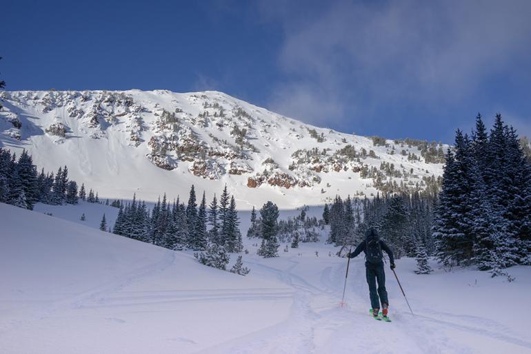
Approach
From the parking lot, head up Blackmore Trail for four miles, passing Blackmore Lake along the way. Depending on fitness level and mental state, you may enjoy a magical meander through the timber or suffer an interminable slog to the basin beneath the mountain's east face. For the most common approach (A), skin up through the trees on the climber's far-right to gain Blackmore's northeast ridge. Amble up the ridge to your desired drop-in point. Be wary that the terrain steepens and becomes more consequential near the summit. For an alternative approach to the summit, from below the east face, skin up to the saddle between Elephant Mountain and Mt. Blackmore (B), and ascend Blackmore's southeast ridge. Gaia GPS route here.

Descent
The most popular descent (C) takes you down through sparse trees on the northern end of the east face. The breadth of terrain and easy ascent here allow for multiple laps. Although relatively safe, this slope has the potential for a large avalanche. The central east face (D) holds remarkable extreme-skiing terrain—getting caught in a slide here would unavoidably carry a skier through large rocks and cliffs. The southeast face (E) takes a long, moderate descent from the summit. A slide here is less likely, but not out of the question, and the terrain is extremely consequential, with the slide path spilling into the cliffs of the east face.
Avalanche Safety
Mt. Blackmore and its surrounding slopes contain a wide variety of terrain, much of which can produce large, consequential avalanches. Our description here indicates zones that carry a higher avalanche risk—do your research before heading out, and know which slopes are of greater concern. Once on location, follow all accepted avy-safety precautions, including digging pits and avoiding questionable areas. Have a backup plan in case you encounter unexpected conditions. On the ascent, choose routes that minimize exposure to avalanche terrain, and ski one-at-a-time down when descending through such terrain, keeping eyes on your partner.
*Avalanche hazard refers to terrain risk only. Always travel with rescue gear, evaluate conditions carefully, and check the forecast before heading out.