Treasure Island
Getting to know the Pryor Mountains.
We all have our favorite retreats in the stately Absaroka, Gallatin, and Madison mountain ranges. But what about our love for the “island ranges?” These mountains, which exist in isolation from larger ranges, include the evocatively named Bears Paws, Crazies, Snowies, Little Belts, Moccasins, Sweet Grass Hills, and Elkhorns, among others. Far from being inferior versions of their larger cousins, island ranges, due to their isolation, often have animal or plant species found nowhere else, and are rich with ecological and cultural history.
Take the Pryors, for example. If you’re looking for an alluring mistress who unveils surprises at every turn, you can’t do better than this compact, sacred landscape. According to the Pryors Coalition, “the Pryor Mountains are utterly different from the Beartooth Mountains only 40 miles to the west. They’re formed by erosion of uplifted limestone instead of glacier-carved granite. The numerous rugged and spectacular limestone canyons provide viewpoints from which to share the solitude with the intermittent, quiet, and haunting call of the hermit thrush.”
Why So Special?
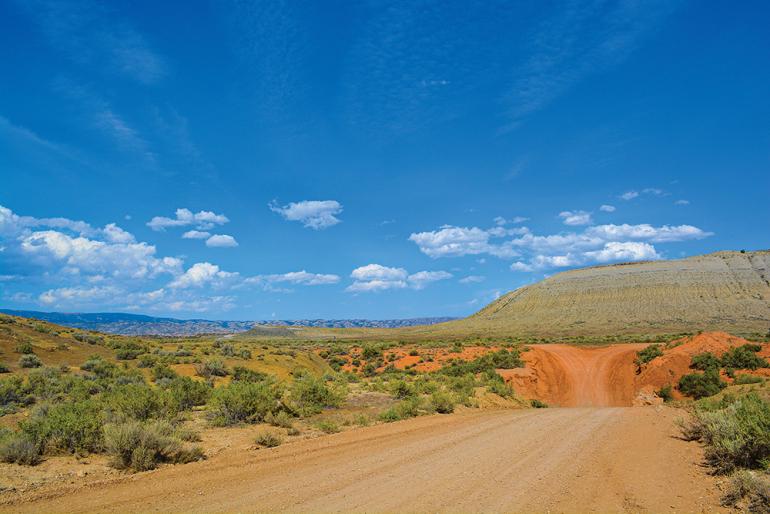
The convergence of three ecological provinces (Northwestern Great Plains, Wyoming Basin, and the Middle Rockies) results in climactic, geologic, and subsequently, biological diversity in the Pryors. From red-desert shrub and juniper woodland reminiscent of Southern Utah, the Pryors continue up through cottonwood draws, Doug-fir forests, and lush grasslands full of wildflowers and wild horses, before finally reaching into sub-alpine forests.
The Pryors are considered a botanical hot-spot, with 40% of the plant species in Montana confirmed in the Pryors, including many rare and sensitive species which grow almost nowhere else. In recognition of this floristic diversity, the Montana Native Plant Society has designated close to 115,000 acres of the southern Pryor Mountain area as an Important Plant Area. The BLM’s nearby East Pryor Area of Critical Environmental Concern also recognizes the importance of distinct plants in the area, and the Burnt Timber Canyon, East Pryor, and Bighorn Tack-On Wilderness Study Areas provide protection for unique plants. Kayhan Ostovar, associate professor of environmental science and fish & wildlife conservation at Rocky Mountain College, says, “Often when you hike in a canyon in the Pryors you feel as if you are in southern Utah. I think many species feel the same and their northern extent exists in the Pryors.”
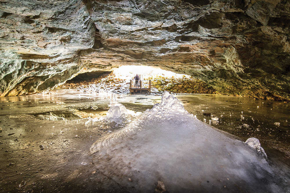
The Pryor Mountains also have a significant density of karst caves (four of which are ice caves), hosting 10 of the 15 known bat species in Montana. Crooked Creek contains a genetically pure strain of Yellowstone cutthroat trout. The rugged deep canyons of the Pryors are home to an Audubon Important Birding Area, hosting diving peregrine falcons, along with more than other 200 bird species.
People of the Pryors
This ecological diversity has long been a draw for humans as well, with archaeological evidence of human use for at least 10,000 years. According to Mike Penfold of the Pryors Coalition, “at the time that glaciers gripped the North, those icy fingers did not touch the Pryor Mountains. As the glaciers melted, Pleistocene animals would soon face a new two-legged predator. The migration routes of those first explorers touched the Pryor Mountains. The earliest human burial found in the United States was laid to rest with a spearhead made from Pryors chert. Ancient trails, marked with stone cairns, trace the routes of our continent’s first humans. Caves sheltered those earliest hunters who etched their stories into sandstone cliffs and left circles of stones and toolmaking debris.”
Shane Doyle, an Apsáalooke tribal member and cultural consultant, tells me, “Island ranges were what made Montana special to plains Indians, and separated the area from other places on the Great Plains. Because of their supply of lodgepoles, winter campsites, fresh water, and numerous plant and animal resources, as well as ceremonial sites, island ranges were indispensable sources of life.”
The Pryors remain as more than an archeological study for contemporary Native Americans. These mountains contain significant spiritual and ceremonial sites for many tribes, particularly the Apsáalooke (Crow), but also the Tsistsistas & Suhtaio (Northern Cheyenne), Shoshone-Bannock, and Eastern Shoshone tribes. The landscape is integral to their ongoing cultural practices and medicinal plant, teepee pole, and sundance pole collection.
Doyle says the Apsáalooke people know the Pryors as the Arrowhead Mountains. Dryhead Overlook, a popular day trip, is considered a sacred landscape, a place where a number of Apsáalookeleaders fasted in the difficult transition to reservation life. “Dryhead is named for a Crow chief who placed dried skulls at the base of the overlook. The eastern portion of the range is on the reservation, where the Castle Rock formations are easily distinguishable. They are known for their fasting sites and stories of the magical Little People who have lived there since time immemorial and have a close historical relationship with the Crow people.” Expanding recreation in the Pryors has damaged many of these sacred places. Vandalism, theft, exploitation, and degradation all diminish these areas for tribal use.
Wild Horses
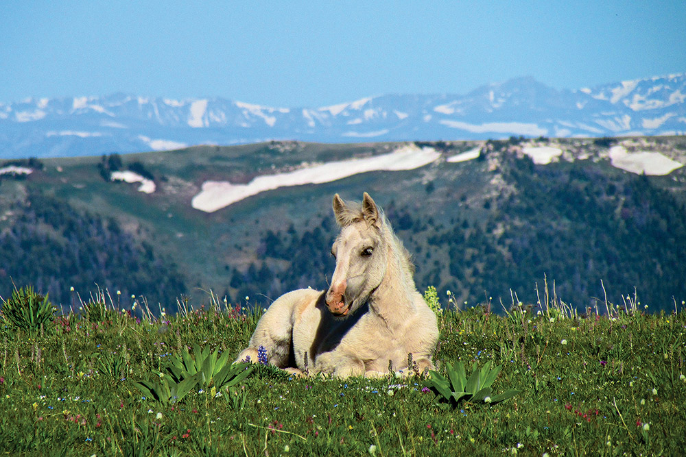
The Pryor Mountain Wild Horse Range, roughly 10 miles north of Lovell, WY, is one of only four designated wild-horse and burro ranges in the country, created by the Secretary of the Interior in September 1968, currently managed by the BLM, and championed by the Pryor Mountain Wild Mustang Center in Lovell. Visitors love these small horses—some with distinct grulla coloring, dorsal stripes, bi-colored manes and tails, tiger-striped legs, and cobwebbing on their faces.
Roads and Trails
Pryor roads are notoriously rough, but agencies have been working to provide seamless recreation experiences for remote travelers, while improving the motorized routes as well. The Forest Service and partnered volunteer groups have also been working to reopen an old non-motorized trail, which starts near the old Sage Creek Ranger Station and goes up Big Pryor Mountain, ending near the old Bainbridge Cabin. The BLM is currently updating its travel regulations for the Pryors, including addressing e-bikes.
What about Wilderness?
While only Congress can formally designate Wilderness areas, the recently completed Custer-Gallatin National Forest Plan Revision expanded one recommended Wilderness area in the Pryors (Lost Water Canyon) and added another recommended area (Bear Canyon), for a total of roughly 18,000 acres, or 23% of the range’s National Forest lands. In addition, the revision added two new backcountry areas: Big Pryor and Punch Bowl. The BLM and Bighorn Canyon National Recreation Area recommended significant portions of their lands in the Pryors for Wilderness designation as well.
Preservation
As with all wild landscapes, many natural and cultural resources of the Pryors are at risk from unintended impacts of recreation. Invasive species could have disastrous effects to this botanical hot-spot, and biologist Kayhan Ostovar states he is “concerned about escape-terrain for wildlife, related to the network of roads.”
But as they stand, the Pryors offer everything you’d need for a responsible weekend of recreation: hiking, bird-watching, horseback riding, hunting, scenic drives, and geology toursabound. “Big, open, and beautiful, the Pryors offer a quiet escape for all sorts of Montanans,” says the Pryors Coalition. “As long as we approach this place with care, visitors will be able to listen to the wind whispering through the canyons, smell the abundant flowers, and enjoy sweeping vistas of the Beartooth and Bighorn mountains.”
Off the Beaten Path
by John Clayton
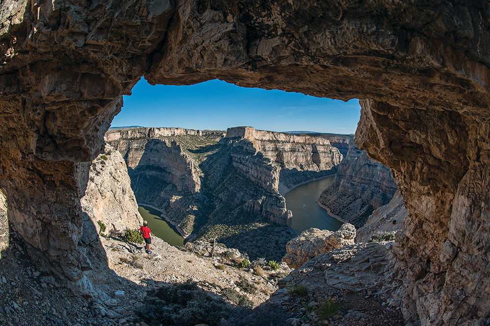
Lying flat on the jagged rock, I inched forward. No sense taking chances with my balance in a situation like this. I poked my head over the edge of the cliff and looked 500-plus feet straight down. The lake covering the bottom of the steep dry canyon was placid and green.
If that sounds like a description of Utah’s Lake Powell, it felt that way, too. But I was in Montana, hiking our own stark canyons and juniper flats—southern Utah with less red.
East of the Pryor Mountains, the Bighorn River cuts through rugged, parched, thinly-populated land. As at Lake Powell, it was dammed in the 1960s, and the resulting 71-mile-long lake is known primarily as a power-boating mecca.
But on a warm spring day, when snow still covers the higher elevations, a hike in the southern end of the Bighorn Canyon National Recreation Area can provide the sense of a trip to the southwestern deserts, at a fraction of the distance.
The trail along lower Layout Creek is an old two-track road across desert shrubland, backed by the dramatic eastern front of the Pryor Mountains. When I go, I marvel at yucca and prickly-pear cactus, and once had to pull several spines from my left thumb (I could tell you I was testing to see if they were real, but in truth I was just clumsy). Juniper abound, and while the live trees provide a touch of green in the overwhelmingly brown landscape, the dead ones resemble glorious sculptures.
The Layout trail runs through the Pryor Mountain Wild Horse Range, and if you’re lucky, you’ll see these magnificent creatures roaming free. You may also see cottontail rabbits and the bighorn sheep that gave the river its name.
It’s a great place to get your legs back into hiking shape, but it’s more than a mere walk in two ways. First, there are stunning canyon views at the end of the trail. (There are no fences, so keep children close as you near the canyon’s edge.) Second, like most desert hikes, rich rewards come to those who venture off-trail.
Though the official trail stays at least 50 feet above the rim of the ever-deepening Layout Creek Canyon (and I prefer to leave the trail to look down over the rim), in dry seasons, I also enjoy poking along the bed of Layout Creek itself. It drops from the trailhead toward the lake, twisting through cliffs of Madison Limestone. This 300-million-year-old rock forms the rim of the entire length of Bighorn Canyon, and a fault line forms the dramatic face of the Pryors. Against a cliff at noon, out of the wind with the sun overhead, you arrive at a wonderful feeling, much welcome at this time of year: summer.
Directions
Though the trail is in Montana, you access it near Lovell, Wyoming. Stop at the visitor center to pick up a trail guide, then drive Route 37 north into the Bighorn Canyon National Recreation Area. After you cross back into Montana, proceed 6.3 miles to a cattle guard marking the northern end of the wild-horse range. Park on the side of the road before the cattle guard. The trail (an old two-track road) goes off to the right. It forks after a third of a mile; keep right to stay south of Layout Creek. As you get close to the canyon rim, you may want to leave the trail to get the best views.
The trail guide recommends looping around to the south for an easy-to-moderate three-mile loop back to your car, offering panoramic views of the Pryors. However, for those who prefer to stay on the trail, this part is more difficult to follow, and for those who prefer to venture off it, the rewards are less dramatic than the stretch along Layout Creek.
If you’re feeling ambitious, hike upper Layout Creek, a canyon along the face of the Pryors. That trail starts another half-mile up the road at the Ewing-Snell ranch historic site.

