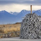
Mind the Markers
A land-surveyor’s perspective on corner crossing.
I read the corner-crossing articles by E. Donnall Thomas Jr. with interest (“At a Crossroads,” Spring 2023 & “Clouded Judgement,” Summer 2023). I’m like-minded in his disgust and anger at the greed of those who would keep us from accessing our own land. As a retired professional land surveyor, I would like to elaborate on the nature of these corners as it pertains to public-land hunters, and offer my personal opinion.
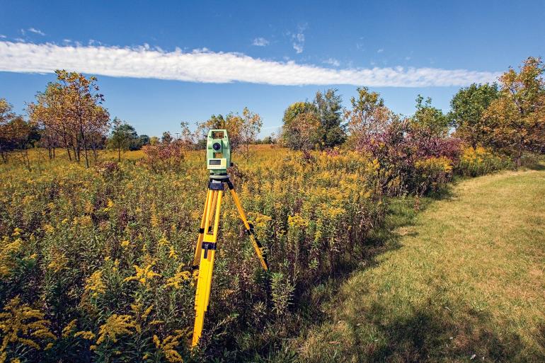
Most of the common corners in a checkerboard are section corners. Section lines were typically intended to be at right angles, but sometimes they vary significantly from this trend. Don is correct in that each common corner is a theoretical point, but most of these corners have, or had, a visible monument in the ground marking the location. Virtually all section corners were required to have a monument set by the original surveyors (or nearby as a reference if the actual corner couldn’t be set). In our area, many of these early corners were originally designated with marked stones or other natural materials. After about 1920, most corners were designated with a substantial metal rod or pipe topped with a metal disk or cap stamped with the section numbers. Some original monuments that were destroyed or obscured have been re-designated with metal. Many monuments are at or below the ground surface and are not visible.
As surveyors, we are taught that property boundaries extend down into the earth and upwards into the air, at least for a ways.
GPS technology is an amazing tool, but a handheld GPS unit alone does not “precisely” identify corner locations close enough to be sure of where you are placing your foot at a corner. A handheld unit shows the user’s location in relation to a digital model based on latitudes and longitudes, or other forms of coordinate information. But there are two weaknesses to be aware of. First, with a clear view of the sky and with good satellite geometry, the handheld unit can often read within 10 feet or so of its actual position. But in poor conditions, the unit can easily be over 20 feet off. Second, the digital model of property lines and corners programmed into the GPS device is not necessarily 100% accurate. The model may well demarcate boundaries within a few feet, but in many cases that is not the norm. Sometimes, more accurate dimensions from recent surveys don’t get entered correctly into the model. And sometimes subsequent surveyors make mistakes. North of Logan, I once found an original stone section corner more than 200 feet east of an incorrectly-established corner of record that had been recently set by a previous surveyor using faulty fence evidence. Errors of this magnitude are rare, but significant discrepancies do exist.
I’m pointing these issues out because knowledge of the exact corner location is apparently known in the Wyoming case. A stamped disk was visible at the corner in question. In many cases in our area, the precise location may not be known. Is precise location important?
When the government created the checkerboard configuration, it never intended to create public parcels that were not accessible to the public.
As surveyors, we are taught that property boundaries extend down into the earth and upwards into the air, at least for a ways. If your neighbor’s garage eave extends across your common property line, it encroaches on your property. (Don’t be a jerk about it. Let your neighbor know that you are aware and give permission. Permission can be revoked.) I think access across a corner is different: the eave is usually a stationary result of a mistake, while access is a momentary exercise of an apparent right.

When the government created the checkerboard configuration, it never intended to create public parcels that were not accessible to the public. The legal vagaries of access through corner crossing need to be clarified by state or federal legislation to conform with the government’s original intent, without trampling on private-property rights. It makes sense to me that access should not be denied just because a corner location is not precisely known. I personally think the law should address only pedestrian access.
In the future I expect that we will increasingly see property owners construct fencing or low-value buildings at common corners that make crossing at the corner physically impossible. Any legislation should specifically prohibit this practice where public property is involved. Statute language needs to be carefully crafted to withstand inevitable court challenges. Without clear legislation, our rights are subject to the whims of current courts based on nebulous existing law. We need to do this now for our children and grandchildren.
Steven C. Anderson is a professional land surveyor licensed in Montana and Wyoming.