Wacky Tobackies
Hiking the Tobacco Roots.
As a young boy, I was fortunate to have parents who appreciated the outdoor opportunities Bozeman had to offer. I can still picture an early trip up the rough and dusty road of Hyalite Canyon to get my first glimpse of the mountains that have been dominating my life for years. Southwest Montana has given me a lifetime of hiking and climbing destinations, including such gems as the Crazy, Bridger, Absaroka, Gallatin, Madison, and Beartooth mountain ranges. The one range I have neglected over the years was the line of towering peaks to the west of the Gallatin Valley: the Tobacco Roots. There isn’t any particular reason why we weren’t hiking in the Tobacco Roots. There were just so many other places to visit. Six years ago, our exploration of the range began, and my family and friends have truly fallen in love with the rugged peaks, raging streams, abundant wildlife, and the mining history of the late 1800s to early 1900s. Here are three climbs to try before the snow starts flying.
Easier: Mount Bradley / Lady of the Lake Peak
Elevation: 10,367/10,218
Estimated Time to the Top: 1 to 2 hours
Latitude and Longitude: Bradley - N 45.5201 W 111.9758/ Lady of the Lake - N 45.5150 W 111.9681
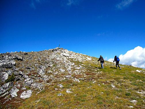
Mount Bradley and Lady of the Lake Peak are just east of Branham Lakes near Sheridan, Montana. Mill Creek Rd. leads directly to the Branham Lakes Campground and a starting point of over 8,700 ft. The high elevation beginning and the short distance from the lake to Mount Bradley is why I gave this an “easy” rating, even though there's no trail. The hike will require some navigating and a little scrambling, but with today’s smartphone apps and GPS technology, the task is much easier. My family and I parked at the campground and headed toward the northwest ridge of Bradley where we were able to scramble up to a very wide ledge on the southwest face of the mountain. This southwest face route leads diagonally southeast and up to the southeast ridge of Mount Bradley. After reaching the ridge, the two choices are to head northwest to the top of Bradley or southeast to the top of Lady of the Lake. The hike takes very little time to reach the ridge, so we decided to do both. On the day of our hike, we watched a grizzly running full speed down the west face of Lady of the Lake into the trees below, so don’t forget to pack your spray. The view of the Gallatin Valley from these two mountains is simply stunning.
Driving Directions: There are two ways to arrive at Branham Lakes. The first is to drive to Virginia City and then head north along Hwy. 287 to Sheridan. The second route follows Interstate 90 to Whitehall and then south along Hwy. 41 to Twin Bridges. At this point, travel south on Hwy. 287 to Sheridan. Once in Sheridan, head east to the lakes along Mill Creek Rd. for 13 miles. This road can be rough at times and might require four-wheel drive. Both routes are going to take a little over two hours of driving time to arrive at Branham Lakes.
Moderate: Middle Mountain
Elevation: 10,353
Estimated Time to the Top: 3 to 4 hours
Latitude and Longitude: Middle - N 45.5861 W 112.0521
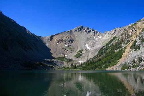
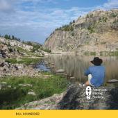
The trailhead to Middle Mountain is located in the South Boulder Drainage, about four miles south of Mammoth. A beautifully constructed National Recreation Trail leads four miles south to Lake Louise, a popular destination in the Tobacco Roots for hikers and fisherman. From Lake Louise the route to the peak is fairly obvious. Continue south around the west side of the lake to gain access to a bowl, which leads to Middle Mountain’s northeast ridge. Head southwest along this ridge toward the peak, keeping in mind the highest point of the mountain is the south spire. I climbed the spire just north of the higher point, because we weren’t sure which was the actual peak. The view of Lost Cabin Lake and many of the other Tobacco Root Mountains is truly spectacular from the top of Middle Mountain.
Driving Directions: The easiest access to the South Boulder Drainage is to drive to Cardwell, Montana on Interstate 90. After arriving in Cardwell, head south on Hwy. 359 for 4.5 miles. Turn right onto the South Boulder Rd. for 12 miles to Mammoth. Continue south to the trailhead near the Bismark Reservoir (Trail #7168). The road from Mammoth to the trailhead can be quite rough, so again, I would recommend a four-wheel drive.
Extreme: Hollowtop Mountain / Mount Jefferson
Elevation: 10,604/10,513
Estimated Time to the Top, from the west: 3 to 4 hours.
Estimated Time to the Top, from the east: 4 to 5 hours.
Latitude and Longitude: Hollowtop - N 45.6115 W 112.0082/ Jefferson - N 45.6028 W 112.0067
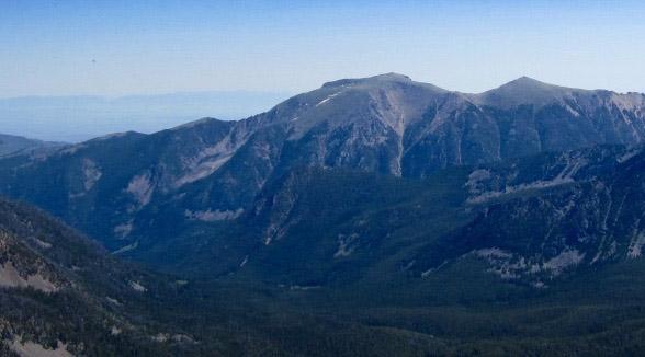
Hollowtop Mountain and Mount Jefferson are the two highest peaks in the Tobacco Roots. There are many approaches to these mountains, so I am going to describe two different routes, one from Pony, and the other from the South Boulder. The route beginning southwest of Pony has quite a bit of trail, but the distance is greater. The route from the South Boulder drainage is shorter, but there isn’t a trail, and the climb is very steep.
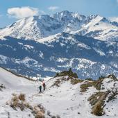
East-Side Route: The North Willow Creek trailhead (Trail #6301) is located two miles southwest of Pony. The trail leads to Hollowtop Lake, a distance of about four miles. The trail continues around the west side of the lake for a short stretch to Deep Lake. At this point, the official trail ends, so heading northwest from the stream leading into Deep Lake or an adjacent game trail will put you on the path to Skytop Lake and the unnamed pond sitting at the base of a large bowl located between the mountains. Climb southwest, scrambling up the bowl to the ridgeline connecting Hollowtop and Jefferson. The ridgeline walks to both mountains offer breathtaking views in all directions.
Driving Directions: Drive to Harrison from either Interstate 90 or Norris. Head southwest along the Pony Rd. for six miles to Pony and then continue on for another two miles to the trailhead.
West-Side Route: The route from the South Boulder drainage is very difficult no matter the approach. There is no trail, so bushwhacking and navigation skills are essential. And to top it off, the distance from the trailhead to Hollowtop is about two miles as the crow flies, however, the elevation gain in this short distance is 3,800ft. The best way I can think of to describe this route is a Stairmaster with obstacles. Even though I'm portraying it as the route from hell, I've climbed the mountain twice from this side and enjoyed every difficult step. The hike begins a little over two miles south of Mammoth. An outhouse on the left side of the road is the starting point. Park here and begin walking down the left fork of the road, which leads to the old Nicholson Mine (The right fork leads to the Lake Louise / Lost Cabin Trailhead). This is a tough route to describe, so I’m going to list waypoints, keeping in mind, the path might need to be altered somewhat due to the terrain. The first waypoint is approximately the spot to leave the road and begin the climb (N 45.6208 W 112.0330). The second point is the halfway mark between leaving the road and Hollowtop (N 45.6201 W 112.0342). From this location at 9,400 ft., continue hiking in a southeast direction to the summit of Hollowtop. Jefferson is also a possibility if there is time.
Driving Directions: The diving directions are for the most part the same as the Middle Mountain hike. After arriving in Cardwell, head south on Hwy. 359 for 4.5 miles. Turn right onto the South Boulder Rd. for 12 miles to Mammoth. Continue south for about two miles until the road forks. Conveniently, there is a Forest Service outhouse marking the beginning of the hike located at the fork in the road.

