Field Forecasting
Reading the weather.
When it comes to preparing for weather, most of us are decidedly reactive: see raincloud, grab parka. Even the most scrupulous student of the skies does little more than read the newspaper’s daily forecasts and check the latest updates on her smartphone. As a result, we’re often caught, during a sudden storm, with our proverbial pants down.
But that’s unnecessary, says Kathy Crawford, professor emeritus of geography at Montana State University. By simply being aware of what’s going on around you, she says, "you can call the weather pretty well." And calling it means knowing how to dress for it – a particularly important task in Montana, a state that holds the national record for the greatest temperature change in 24 hours, from a frigid -54 degrees to 49 degrees. That’s the North Pole to California in a day, friend – pack inadequately for a backcountry trip during that colossal shift, and you’ll find yourself a permanent part of the landscape.
Meteorological Forces
Bozeman gets most of its weather from the west. Strong Pacific winds stream across Oregon and Washington, rising up along the Rocky Mountain front. Through a process called orographic lifting, the air cools and condenses, releasing its moisture on the mountains as it passes overhead. In the wintertime, this means snowfall, and lots of it. As spring approaches, the gulf stream begins to influence Bozeman’s weather patterns. Large air masses from the Gulf of Mexico, traveling northward along the eastern edge of the Rockies, generate intense low-pressure systems. Whirling counterclockwise, this moist, warm air converges with local cold air masses to cause huge late-season dumps. Because of the alignment of neighboring mountain ranges, Bozeman can be extremely susceptible to certain storm systems, especially those out of the northwest. Low-level gaps in British Columbia and the Columbia River Gorge, for example, allow warm, unstable air masses to accelerate in our direction and collide with cold air over Bozeman. Colder temps and heavy snowfall are usually the result.
Forecasting
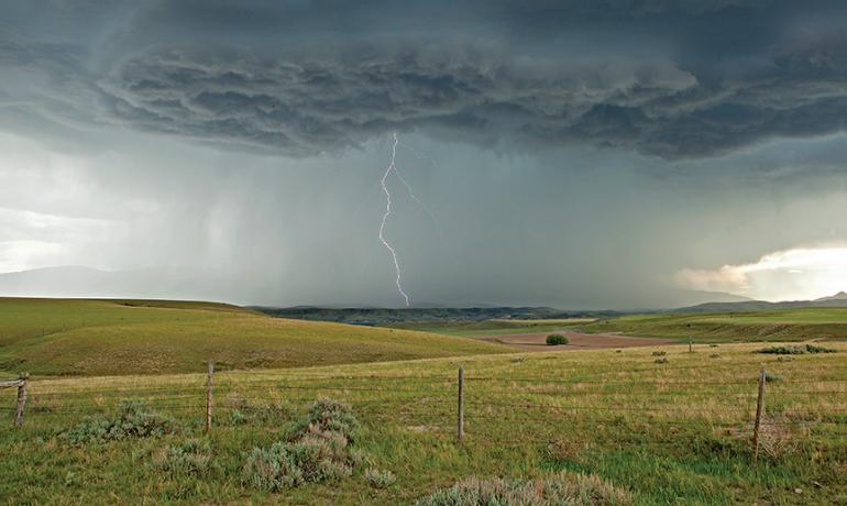
"Keep your eyes to the west," Crawford advises. "Look for changes in cloud structure, wind speed, and temperature." High clouds in the western sky, for example, herald an approaching front. Look for cirrus clouds first, says Crawford – "high, wispy clouds made of ice crystals. They’re on the leading edge of a large air mass." Stratus clouds – flat, midlevel cloud layers – come next, and behind them are the immense, billowing cumulonimbus formations. We all know what they bring: cold temperatures and, more often than not, a heavy blanket of snow. Wind shifts are equally good indicators of changing weather. "If the wind shifts to a north or northwest wind," she explains, "that means lower temperatures are coming. If the temperatures are low enough and there’s moisture in the air, precipitation will occur." A wind shift out of the south or southwest, on the other hand, signals a new warm air mass moving into the area, which can also bring snow but with warmer temperatures.
"When you have an approaching front, you get low pressure," Hansen says, "and the lower pressure causes air to rise and hence to cool, condensing water vapor in the atmosphere and thus causing precipitation." So watch the barometer – it too may indicate an approaching storm.
Forecasting is all about observation, Crawford explains, about taking the time to look for signs and then interpreting what you see. But, she warns, you can never be too sure. "Even the best forecasters are often wrong," she says. "That’s what makes weather so exciting – you can never be absolutely sure what to expect.”


