Our Checkered Past
And our checkerboarded present. A history of patchwork land ownership in the west.
To prove legal title to land, one must trace it back to the man who stole it.
—Lloyd George, former Prime Minister of the UK
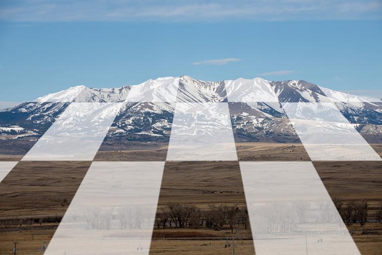
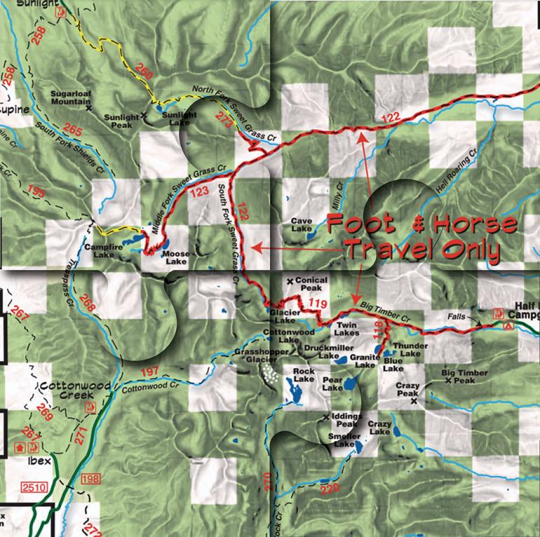
Right triangles, trapezoids, parallelograms... remember all of those nifty, precisely designed shapes from high-school math class? One hardly ever encounters any of them in nature. The same can be said of their most elemental component: the straight line. So, why are so many straight lines running through Montana, whether on a USGS topo map or inside a DeLorme atlas? And what about those rows of alternating squares that make parts of Montana look like a checkerboard on color-coded maps identifying public and private land? The answer, of course, is that we put them there for our own purposes, which weren’t always admirable. One cannot understand what those artificial lines mean today without understanding how they got there.
For those of us interested in Montana’s outdoor bounty and the means of accessing it, these imaginary lines assume particular importance when studying maps that identify land by ownership, especially in the distinction between public and private property. The former is, or at least should be, accessible by anyone, while no one disputes that landowner permission is required to recreate on the latter. The principle becomes especially confusing when studying a map of Montana. Newcomers to the state will soon notice that many of the boundary lines between public and private look as if they had been drawn with a ruler—never mind the rivers, drainages, and mountains customarily used to provide points of geographic reference.
Understanding how it got that way requires a backward journey through American history to the Civil War era.
As the West began to open up during the 19th century, thanks to expansionist instincts and the notion of manifest destiny, several imaginative entrepreneurs began to lobby for railroads and telegraph lines to connect the East Coast with the Pacific. In most cases, they were inspired by what is perhaps the most characteristically American of motivations: the possibility of making money. Plans initially focused upon a theoretical “southern route” between St. Louis and San Francisco. As this idea repeatedly foundered on obstacles ranging from terrain to politics, a hustler from Maine named Josiah Perham began to promote an alternative “northern route” running from the Great Lakes to Puget Sound.
Despite the distractions of the Civil War, in 1860 industry lobbyists and Congressional expansionists introduced the idea of granting federal lands along the southern route to railroad companies as a means of compensating them for the cost of laying track. The idea didn’t progress until 1864, by which time Perham’s original Peoples’ Pacific Railroad had become the Northern Pacific. Congress initially offered a 200-foot right of way on either side of the track to cross federal lands along the northern route. After more lobbying, the railroad wound up receiving up to 20 sections of land per mile of track across federal property and 10 sections on state lands. The math reveals an astounding total of 40 million acres gifted to private interests, almost all of it in the West.
To avoid creating large, continuous parcels of private land and to encourage homesteaders to settle near the railroad, the charter specified that the sections alternate. When the surveying was done, most of the land adjacent to the Northern Pacific’s route looked like a checkerboard. The initial legislation required the railroad companies to sell some of this land at reduced prices to homesteaders once the railroad was complete, an outcome deemed in the national interest. Homesteaders did get some of it, but to raise more capital, the railroad began to sell off its land-grant property to corporate interests ranging from timber companies (e.g., Weyerhaeuser) to mining (Anaconda Copper).
Not everyone was happy with this massive giveaway. After years of argument and litigation, President Woodrow Wilson ruled that the railroad companies had not met their contractual obligations. The result was a compromise in 1924, calling for private parties that had acquired land-grant properties to “revest” much of their windfall acreage back to the federal government. Some did, but some didn’t. In Montana, lots of bits and pieces eventually wound up in ranchers’ hands, but a huge chunk now belongs to Plum Creek Timber, the current incarnation of Weyerhaeuser.
That is a brief summary of how so much of Montana came to look like a checkerboard, a situation that has created numerous practical problems. Those straight survey lines do not respect terrain or habitat considerations, meaning that a lot of land wound up in the wrong box. This creates a nightmare for land managers and wildlife biologists, who may have to administer policy for a single mountain range or drainage including land owned by private parties, as well as public land managed by their own agency.
As most readers know, public access to public land has become a lightning-rod issue in Montana for a complex variety of reasons beyond the scope of this piece. In theory, checkerboarded land should offer more help than hinderance, but as usual, there’s a catch.
Montana law has still not settled the matter. Neither Fish, Wildlife & Parks nor the Forest Service has endorsed either side of the question.
Wherever four adjacent sections meet, they form a point defined by the intersection of two boundary lines, one running north-south and one east-west. A point is perhaps the most ethereal of all geometric concepts. You can’t see it, can’t touch it, and wouldn’t know it is there but for some antiquated survey work defining the distinction between public and private land. In theory, whenever a hiker or hunter reaches such a point in the backcountry, he or she should be able to keep one foot on one piece of public land and step onto the adjacent section without trespassing, an act known as corner-crossing. If only it were that simple...
Many private landowners have taken the position that corner-crossing constitutes trespass. In fact, no Montana law makes corner-crossing legal or illegal, leaving the decision to file trespassing charges up to individual county attorneys. Predictably, the results have been mixed, creating confusion around the state. Bills attempting to clarify the matter by formally legalizing corner-crossing came before the Wyoming Legislature in 2011 and Montana’s in 2013. Both were defeated. Other western states (Utah, Idaho, Colorado, New Mexico) have specifically identified corner-crossing as trespass. Meanwhile, over 700,000 acres of public land in Montana remains inaccessible because of inability to cross corners legally.
I find the legal reasoning behind trespass charges against corner-crossers highly specious. There would be no basis for argument unless the landowner actually owned the airspace above the land—as James Cox Kennedy’s attorney asserted before our Supreme Court in the notorious Seyler Lane access case, and as did at least one Montana legislator during the 2013 hearings. Illogical as it seems, that argument is still being made, although no court has affirmed that opinion. Montana law has still not settled the matter. Neither our Fish, Wildlife & Parks Department nor the Forest Service has endorsed either side of the question. However, the federal government assigns all airspace management issues to the Federal Aviation Administration, whose position is that “A citizen of the United States has a public right of transit through navigable air space.”
This policy begs the question of what constitutes navigability, a dilemma that plagued stream-access advocates for years and resulted in many often-contradictory legal opinions. Simply stated, navigable air space (or streamflow) is that which one can navigate, a tautology that for practical purposes doesn’t clarify anything. In cases that resulted in formal trespassing charges for corner crossings, the courts haven’t provided much clarity either. However, the FAA has largely abandoned earlier attempts to define navigability in feet AGL (above ground level), and recent court rulings elsewhere have tended to accept that any air space is potentially navigable. The recent popularity of recreational drone flight will likely keep the matter before our courts for the foreseeable future.
If corner-crossing is illegal, for practical purposes that private landowner acquires another 640 acres to add to their private fiefdom.
A recent court case in Park County may have set a significant precedent. Cody Cherry, a retired horse trader who lives near Livingston, regularly hunted on checkerboarded land divided between the Custer-Gallatin National Forest and the private Point of Rocks ranch. After ranch owners complained multiple times about Cherry trespassing at corner-crossings, charges were filed and then dismissed, largely on the basis of a former Park County Attorney’s opinion in another case that “It was not trespassing to go from one section of public land to the next over that infinite corner.”
Faulty surveying (much of which took place in the 19th century) can further complicate an already complicated area of legal reasoning, as it did with another charge involving the same two parties in 2019. Sometimes, the boundaries just don’t line up correctly where they meet at a corner. Such proved the case in this instance, and Cherry had to cross a short segment of private land to reach the opposing public section. His conviction on trespassing charges was eventually upheld by the Montana Supreme Court.
After all this, some might wonder why private landowners are fighting so hard against the concept of corner-crossing. This impulse usually turns on simple matters of human nature (greed, selfishness) and plane geometry. A public section bordered on two opposing sides by private land owned by someone with these personal character traits may be legally inaccessible. If corner-crossing is illegal, for practical purposes that landowner acquires another 640 acres to add to their private fiefdom. The temptation is too much for many landowners, especially those new to the state and its traditional values.
It is time for Montana law to clarify the matter, although given the stridently anti-public lands posture in the past legislative session, I don’t see that happening any time soon. The issue just doesn’t seem that complicated. To be guilty of trespass, one would have to be found guilty of stepping on something that doesn’t even exist: that theoretical point where two arbitrarily drawn lines intersect. As noted earlier, you can’t see it and you can’t touch it. I don’t see how you can trespass upon it.
So, no thanks to Josiah Perham, J. P. Morgan, and James J. Hill, the railroad barons who created the problem in the first place. This is not the time to quit, however. Growing tired of playing defense in the courts, several of the public-lands advocacy groups to which I belong are actively looking for opportunities to be proactive. A simple bill to legalize corner-crossing in Montana would be a great place to start. Sure, passage would be unlikely given the current composition of the state legislature—but that’s just the kind of impasse citizens’ initiatives were designed to address.


