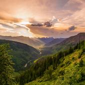
The Pulse of the Forest

Custer-Gallatin Revision Plan update.
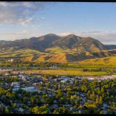
By early fall, the Custer-Gallatin National Forest will be nearing the completion of the first phase of Forest Planning, the Assessment of Existing Conditions. This baseline of knowledge is foundational for the rest of the four-year process, as it identifies what information the Forest Service has now and where information gaps may exist. This summer, the second round of public meetings aims to share initial Assessment results, ideas about the need to change the existing Forest Plans, and ideas from the public about the state of the Forest. Public meetings will be held from June 20 through June 30 across five locations in southwest Montana. There will also be opportunities to participate online. Here are the details:
June 20 - Big Timber, Big Timber High School Cafeteria
June 21 - Red Lodge, Edgar Gruel Building, Carbon County Fairgrounds
June 22 - Gardiner, Gardiner Community Center
June 23 - Webinar Series
June 28 - West Yellowstone, Povah Community Center
June 29 - Bozeman, Chief Joseph Middle School Multipurpose Room
June 30 - Webinar Series
Visit fs.usda.gov/custergallatin for more details.
A taste of what we heard
Initial public meetings were informative and well-attended. Resounding themes ranged from recognizing the diversity of the Forest to studying the economics of an area and how local economies interface with the Forest. Continued maintenance of existing trails and infrastructure, and balancing all multiple uses were also important topics, along with clarifying questions about a number of land designations.
Some baseline facts
Of the nearly 3.1 million-acre Custer-Gallatin National Forest, nearly 1.1 million areas are existing Congressionally designated Wilderness Areas, including the Absaroka-Beartooth Wilderness and the three units of the Lee Metcalf Wilderness. But many other designated areas exist, including:
- 1 Wilderness Study Area known as the Hyalite Porcupine Buffalo Horn created by Congress as part of the 1977 Montana Wilderness Study Act.
- 1 Recreation and Wildlife Management Area, the Cabin Creek Recreation and Wildlife Management Area.
- 1 Wild Horse Territory designated under the 1971 Wild Horse and Burro Act, as a refuge for wild horses.
- 3 National Natural Landmarks recognizing and conserving sites, including Middle Fork Canyon in the Bridger Mountains.
- 7 Recommended Wilderness Areas (not designated by Congress)
- 10 Research Natural Areas established to maintain representative areas of natural ecosystems and areas of special ecological significance.
- 12 Eligible Wild and Scenic Rivers (not designated by Congress) including segments of the Madison, Gallatin, Yellowstone, Boulder, Clark's Fork of the Yellowstone, Stillwater, and West & East Rosebud creeks.
- 13 National Recreation Trails totaling over 100 miles and 27 miles of the Continental Divide National Scenic Trail.
For more information about these specific designations, or to get involved with the Forest Plan Revision, visit fs.usda.gov/custergallatin.