Love It or Lose It
The urgency of open-space preservation.
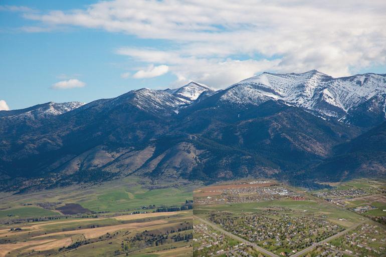
On my first bike ride of the season, I did my usual loop—south on Sourdough to Nash, then 3rd Ave. back into town. In the seven months since I’d last done the same ride, I was startled by the amount of new development in this part of town. Over the winter, some previously fallow parcels had been stripped to dirt, others built up with cement foundations, and a few now contained houses covered in a veneer of Tyvek. Looking south toward the Gallatin Range, it was the same story: new houses dotted the valley, right up to the Forest Service boundary. I found myself wondering, how did we arrive here, and why aren’t we doing more to protect that which remains? To find out, I dug into the history of open-space efforts in Bozeman.
What I found is complex, and boils down to a very Montanan way of doing business—unsurprising, I suppose, in a city that was once a small ranching town, and is not necessarily reflective of its current demographic. Unfortunately, no matter how I looked at the issue, I kept coming to the same conclusion: we’re doing too little, too late.
First off, explosive growth is nothing new, and is by no means unique to Bozeman. We’re just perceiving it in real time, which makes it feel that much more personal and impactful. But take a few steps back to examine it in a broader context, and a few cities come into focus that experienced a very similar, equally explosive growth pattern. We’ll look at two of them: Boulder, CO and Missoula, MT. Both college towns, both nestled at the base of the mountains, both populated by large numbers of outdoor-oriented folks. But more importantly, both with thriving open-lands programs—although they came to fruition by somewhat different means.
Conservation easements are a good place to start, as they stave off development, but for the community to fully enjoy and feel connected to open lands, we need access to them.
Boulder got the ball rolling in the 1950s. Two University of Colorado professors—mathematician Robert McKelvey and physicist Albert Bartlett—recall peering at the base of the Rocky Mountains above their hometown thinking, we have to do something about all the houses being built in the foothills. The two banded together and brainstormed an initiative, now known as the “Blue Line,” prohibiting the City of Boulder from pumping water uphill, thereby curtailing development in the water-parched mountains west of town. In 1959, voters approved the charter amendment by a landslide, establishing an imaginary line at around 5,750 feet in elevation, snaking through the foothills and setting the direction for future development in the city.
Shortly thereafter, in 1967, voters passed a 0.3% sales tax increase for the City of Boulder to buy, manage, and maintain open space—a first in the country. Now, 65 years and several voter-approved sales taxes later, the city owns and manages 46,000 acres of land and 155 miles of trails nearly surrounding the city in a donut-shaped fashion.
The City of Missoula took a similarly proactive, albeit slightly different approach. In 1980, when the city first proposed a program to acquire and manage open-space lands, they looked to Boulder as an example, but quickly hit a roadblock: Montana, like only a handful of other states, doesn’t impose a sales tax. As an alternative funding source, voters approved a half-million-dollar City Open Space Bond—the first in a series of general obligation bonds, which was used for the purchase of lands on Mount Jumbo, Mount Sentinel, and in downtown Missoula along the Clark Fork. All three are now home to trail networks accessible just minutes from town.
Based on the county’s Future Land Use Plan, nearly all acreage from Bear Canyon to the base of the Gallatin foothills, then west to Cottonwood Creek, is zoned for urban development.
It wasn’t until 1995, however, that the city developed a complete Urban Area Open Space Plan, in which they outlined their vision to “conserve, protect, and connect Missoula’s system of open-space lands to achieve a coherent and connected open-space system, with access to a park, trail, open-space land, natural area, or recreation area available in every neighborhood.” Voters passed another bond shortly thereafter in 1995, and in 2006 approved the first county-wide bond, allowing for acquisition and management of land in the greater Missoula area. The City of Missoula now owns and manages 4,000 acres of land in and around the city.
Now let’s jump back to Bozeman, 1997—population 30,000, at the time still smaller than Helena. The Gallatin County commissioners, having watched the population already surge by 26% since 1990, created an Open Space Task Force, composed of ranchers, farmers, developers, a lawyer, a conservationist, a planning consultant, and several others. The commission tasked the team with developing a range of tools the county could use to protect its open space.
The first order of business was establishing a working definition of the term “open space.” To do so, the task force enlisted the help of the public, with questionnaires asking residents to rank, in order of importance, what they believed open-space land should be used for. Categories varied from renewable and non-renewable resource production, to recreation, to agricultural value, to historical, cultural, or archeological significance. Unsurprisingly, the majority of responses advocated for the preservation of agricultural land—after all, 60% of the county’s population lived in rural areas outside of Bozeman or Belgrade.
Summing up the public feedback, the Task Force wrote, “There is very little time before development pre-empts the possibility of effectively preserving open space and the agricultural economy and quality of life that we have known in Gallatin County.” Based on this vision of preserving the “agricultural economy” of the valley, the Task Force recommended a number of financial and planning solutions (including an Urban Growth Boundary—which was clearly not selected) to preserve the rural lifestyle that county residents valued. Namely, the Task Force identified conservation easements as the most economically prudent method of protecting land, and set an urgent timeline, estimating that “in 5 to 10 years it will be too late to preserve open space to the extent needed to maintain quality of life.”
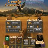
Shortly after the Task Force’s report, Gallatin County voters approved two $10 million bonds—one in 2000, and the second in 2004—to be administered by the County Open Lands Program for financing conservation easements that protect working farmland. Both bonds barely snuck through, and were paid for by increase in residential property taxes, with an exception for agricultural producers. Aside from $2.5 million earmarked for parks and recreation, the Open Lands Program spent nearly the entirety of the money on the purchase of conservation easements in the Valley—to the tune of nearly 50,000 acres.
Let’s pause for a minute, though, to note that purchasing conservation easements is fundamentally different than land acquisitions. In the establishment of easements, the landowners still own the land, but they forfeit the rights to develop it. Those rights are transferred to a land trust (Gallatin Valley Land Trust in our area), who holds them for the benefit of the public. That doesn’t inherently confer the public rights to use that land, though, or to even step foot on it in many instances; it simply prevents future development.
Conservation easements don't inherently confer the public rights to use the land, or to even step foot on it in many instances.
Jumping back into it, in 2008 the county established its first Open Lands Strategic Plan, in which it clarified the mission of the Open Lands Board: “To work with the County Commissioners and the citizens of Gallatin County to preserve natural lands and encourage the economic viability of agriculturally productive lands.” Sound like rural Montana? Yep. Rather than acquiring critical parcels of land to tie rapidly urbanizing communities to nearby public lands (like Missoula), or preserving large swaths for public use (like Boulder), Gallatin County spun “open space” to more or less mean preserving the valley’s agricultural heritage.
In conjunction with this vision, Gallatin County was simultaneously encouraging growth in the Bozeman area—and continues to do so today. In their 2005 Gallatin County / Bozeman Area Land Use Plan, the county wrote: “In general, with a few exceptions, it is recognized that residential development will take precedence over the protection of open space in the Donut,” with the Donut being the City of Bozeman zoning jurisdictional area.
Let’s contrast that with the City of Boulder’s Open Space and Mountains Park’s charter, which specifies that funds administered by the program may be utilized (among seven other appropriate uses) to purchase “land for shaping the development of the city, limiting urban sprawl, and disciplining growth.” This vision, while drastically different than that of Gallatin County’s, is far from ideal and comes with its own set of drawbacks: artificial growth restraints shift future development to outside city limits, dampen economic opportunities, and drive up housing and rental costs—the final of these being perhaps the biggest kicker to residents of average income.
Looking further down the road, though, it’s difficult to stay positive about land development in the Gallatin Valley.
Even if Bozeman commissioners were to have taken on such an approach in the early 2000s, it’s unlikely that lack of capacity would have halted immigration to town. The same holds true today. If the City of Bozeman were to stop annexing new property, acquiring water rights, and developing water and sewage infrastructure, would people cease moving here? If Boulder is any indication, with a median home price of $1.2 million, the answer is a resounding “no” (and Bozeman is not far behind at $0.85 million). Enough people can, and do, afford to move to Bozeman, despite the skyrocketing price of living. Which begs another question altogether: why doesn’t the city take its own initiative in acquiring open lands? If Bozeman residents are, on average, better-off financially than county residents, and have different land-preservation values (recreation, as opposed to agriculture), why do they remain lumped in with the county for open-space purposes?
A first step to addressing this question is to change the funding paradigm—to shift away from county-wide general obligation bonds. City residents took the initiative to do exactly that in 2018 by approving an open-space and stewardship mill levy to pay for the cost of managing city-owned lands (Note: a mill levy differs from a bond in that the city can only use money it currently has from a city-wide property tax increase, rather than from borrowed funds through a bond). While not appropriated for the acquisition of open-space land, the levy marked a turning point in the independence of the city when it comes to managing land. At some point in the future, the same funding strategy might be used to garner enough funds to move ahead to the next step: purchasing new lands.
Looking further down the road, though, it’s difficult to stay positive about land development in the Gallatin Valley. Based on the county’s Future Land Use Plan, nearly all acreage from Bear Canyon to the base of the Gallatin foothills, then west to Cottonwood Creek, is zoned for urban development. As parcels are snatched up and bulldozed for new houses, it becomes increasingly important—and urgent—to protect what still remains. Conservation easements are a good place to start, as they stave off development, but for the community to fully enjoy and feel connected to those lands, they need to be able to use them. For increasingly difficult and costly land acquisitions, more effort and money will be needed.
After diving into the history, I found myself trying to puzzle out these issues while on another bike ride. Like most things, I realized, solutions follow the money trails—which begin at the ballot box. The way I see it, there are three options for gaining momentum when it comes to open lands. Ideally, there’s the top-down approach: we citizens critically analyze and elect people who want to preserve land for public enjoyment. Folks in key positions, like the mayor and our four other city commissioners, as well as Gallatin County commissioners who in turn appoint people to the Open Lands Board. The second option falls along similar lines—reach out to those same commissioners to voice concern and advocate for the protection of the Bridger and Gallatin foothills. Would you rather those hills be bike trails in 50 years, or suburban neighborhoods? ’Cause the latter is the trajectory we’re on. Support levies and bonds that align with your desires. Just be sure to read them—carefully! You should know by now that if a Gallatin County open-space bond appears on the ballot, it’s probably not earmarked for exactly what you think it is. Finally, there’s the bottom-up approach, which starts with the people of Bozeman. Residents talk about the high cost of living in the Gallatin Valley as a “recreation tax,” meaning the price we pay for residing in such a desirable place. But how about an actual “recreation” sales tax to fund the acquisition of open-space land? While it’s unlikely in a place that’s proudly devoid of sales tax, it’s not inconceivable. I’m not arguing one way or another here, but rather setting it on the table as a potential option.
Regardless of where you stand on the various courses of action, it’s questions like these we should be asking, especially if we want the valley—our valley, our home— to remain livable in the coming decades. For now, though, let’s count the wins, but not get too carried away celebrating the preservation of our agricultural heritage.


