Access Granite

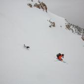
Harvesting corn in the Tobacco Roots.
A close look at any of Montana’s mountain ranges will reveal that many mountain and river names are recycled over and over again, creating repetitive and unoriginal place names. Granite Peak is one of those highly reused names, sharing its name with numerous other peaks in the state of Montana, most notably the state’s high point (which ironically is not, in fact, granite). Granite Peak of the Tobacco Roots is still a worthy mountain, sitting at the center of the range, second in height only to Hollowtop Mountain, while boasting much better skiing. Access is possible via the South Boulder River or South Willow Creek, the latter of which is described here.
Trailhead: South Willow Creek
Distance to Summit: 5.8 miles
Vertical Gain: 4,060 feet
Summit Elevation: 10,590 feet
Time: Full day
Getting to the Trailhead
How far you can drive will depend on snow coverage, and directions are a bit confusing, as some of the roads have several different names. In general, drive as far as you can along South Willow Creek before the road becomes impassible.
From Pony, head south on Potosi Rd, which weaves its way across open fields toward the South Willow Creek drainage. After three miles, turn right and head toward Potosi Campground. In mid-winter, you may have to park at a pullout four miles past this turn. With a 4WD truck and some gusto, though, you can usually make it another mile to the campground. Before the road melts out, a snowmobile or good legs will take you from there. Starting around mid-April, you can drive another 2.5 miles to a fork, where the left fork crosses the creek for the Bell Lake trailhead. You’ll want to stay right, but likely won’t make it much farther. Late in the spring, you can often drive another 3/4-mile, where a forested section of the road holds numerous deep drifts. If you do make it past this section, just a half-mile ahead the road deteriorates significantly as it steeply switchbacks up the north side of the drainage.
Route Description
Stats are based on leaving from the fork near the Bell Lake trailhead. Skin up the right fork along South Willow Creek. After 1.5 miles, the road switchbacks up the north side of the drainage and will appear to take you away from Granite Peak, but this route offers quicker travel than staying in the drainage bottom. After plateauing around 8,100 feet, the road starts to contour and forks again. Take the left fork, which is hard to see as it becomes an ATV road past this point. Continue along the road from this junction for another two miles. Leave the road and skin up to the small bowl coming down from Granite Peak’s east face. The east face is quite mellow, so most parties skin directly up it to the east ridge, which is then just a short walk to the summit.
Descents
Southeast Face: A broad, sunny aspect that is ripe for corn-harvesting on a mild spring day. Ski this one!
Ski Difficulty: Easy
Vertical drop: 1,200 feet
East Face: Not much different than the southeast face.
Ski Difficulty: Easy
Vertical drop: 1,100 feet
North Face Gullies: This aspect is often wind-scoured, severely limiting what you can ski. There are two depressions that run parallel to each other down the north face that often collect enough snow to be ride-able. The far skier’s right of the gullies offers a longer ski if you plan to skin back up to Granite’s east pass before you leave.
Ski Difficulty: Moderate
Vertical drop: 1,100 feet
Exit Notes
The southeast and east faces are easily skied back down to the road you skinned up on, which can be retraced to reach your car. For the north face gullies, skin up the pass directly to the east of the summit to ski back down the way you came in.
This route description is adapted from Peaks & Couloirs of Southwest Montana.