
Bozeman's Top Trails


The five most popular hikes around the Bozone.
Variety and convenience abound in southwest Montana's outdoors—and whether you need a quick hike with the dogs or an epic adventure to rejuvenate the soul, Bozeman’s trails have what you crave. Below are the top five local favorites, where you can walk through the pines, summit a peak, or splash in a babbling creek, all within 30 minutes of downtown.
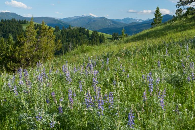
1. M Trail
Length: 3 miles round-trip
Difficulty: Moderate to hard
Features: Wildflowers, rolling hills, views of the Gallatin Valley
Adventurous Add-On: For more of a lung- and leg-buster, continue past the M up to Mount Baldy (another 7 miles round-trip), or veer left below the M and traverse to the Sypes Canyon cutoff (another 5 miles round-trip).

From almost anywhere in town, look toward the Bridgers and you'll see a giant white M on the south end of the range. One of the oldest trails around, the M trail has routes for every level of hiker, each one ending at the base of the M, where stunning views of the Gallatin Valley await. For a more mellow jaunt, opt for the leftmost path, which is longer and winds through fields of wildflowers. The steeper option climbs to the right and gains 800 feet in just over half a mile. Midway up the mellow path is a cutoff that offers a bit of scrambling and a shorter, steeper route to the top.
2. Lava Lake Trail
Length: 6 miles round-trip
Difficulty: Moderate
Features: Rocky creek crossings, forest cover, alpine lake
Adventurous Add-On: Continue past the lake on the steep and rocky trail to Table Mountain. The 10-mile round-trip yields sweeping views of the Spanish Peaks and surrounding mountains.

A 30-minute scenic drive into Gallatin Canyon takes you to this trail, which starts beside the Gallatin River. Three miles of steady uphilling puts you in view of the serene and picturesque Lava Lake. Explore the area around the lake, do some fishing, or take a cold dunk before heading back down.
3. Hyalite Creek Trail
Length: 11 miles round-trip to Hyalite Lake
Difficulty: Moderate
Features: Waterfalls, forest, alpine lake
Adventurous Add-On: Continue past Hyalite Lake to the summit of Hyalite Peak, the second-highest peak in the northern Gallatin Range (another 5 miles round-trip). Views are incredible and typically, so is the wind; bring along a shell or windproof fleece.

Deep in the fabled Hyalite Canyon, past the sparkling waters of the reservoir, is the Hyalite Creek trailhead. Spend the day exploring side paths that lead to flowing waterfalls, or take the trail all the way to Hyalite Lake for a picnic in a serene and picturesque alpine basin.
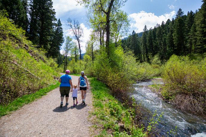
4. Drinking Horse Mountain Trail
Length: 2.5-mile loop
Difficulty: Easy to moderate
Features: Bridge crossing, forest, picnic table
Adventurous Add-On: Loop Drinking Horse with the M for a challenging trail run.
Drinking Horse is a short-and-sweet mainstay, located just across the road from the M Trail. The trail features a cool bridge across Bridger Creek, rolling meadows, and an excellent picnic spot at the top, complete with a full-size table. This is a great hike for kids, older folks, and those who just want to take it easy.
5. Bozeman Creek Trail (Sourdough Canyon)
Length: Varies; 10 miles round-trip to the bridge (most common turnaround)
Difficulty: Easy to difficult
Features: Wooded areas, wide trail, minimal elevation gain
Adventurous Add-On: Head on up the main trail to Mystic Lake (10 more miles round-trip), or explore the singletrack "Wall of Death" cutoff, which is a popular mountain-biking trail.
Choose your own adventure at this popular trail, with everything from a relaxing walk to a vigorous all-day outing. Start from the trailhead just outside of town, and walk, hike, or run to your heart’s desire on this old logging road, which makes for a wide, nicely-graded trail.
For more information about these and other trails around Bozeman, including detailed maps, check out our Trails page.


