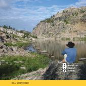
Falling Away

Nice and easy along the Boulder.
Natural Bridge State Monument is located in the main Boulder River valley 25 miles south of Big Timber. The area is named for a limestone arch that once spanned the river. The 25-foot natural arch collapsed in July 1988. Natural Bridge Falls, a 105-foot cataract on the river, surges through the Madison limestone chasm. The waterfall changes throughout the seasons. In the early spring, the surging cataract drops more than 100 feet over the limestone precipice in the river-carved gorge. In late spring, two smaller waterfalls are visible under the main falls. During the summer, the water disappears into a riverbed hole and tumbles out of the lower caverns at the base of the waterfall, revealing the bedrock.
The Natural Bridge Trail is a paved and handicapped-accessible path that follows the Boulder River along ledges and steep cliffs. The popular trail contains several scenic overlooks with interpretive panels. The observation stations explain the geological events that shaped the topography. Fossilized seashells that date back millions of years can be seen in the sedimentary rocks. The East Rim Trail, on the opposite side of the gorge, is a natural path that leads to an impressive viewing spot of the river canyon, falls, and pool.
Driving Directions
From I-90, there are two exits into the town of Big Timber, exit 367 and exit 370. From exit 367, drive one mile to McLeod St. (Hwy. 298). From exit 370, drive 2.4 miles to McLeod Street (Hwy. 298). Turn south on McLeod St., passing through downtown and over I-90.
Continuing south on Hwy. 298, drive 26 miles south into the Boulder River valley to the signed turnoff on the left for Natural Bridge Falls. The turnoff is 10 miles past the town of McLeod. (Hwy. 298 is also called the Main Boulder Road.) Turn left and park in the lot.

Hiking Directions
Walk to the trailhead map and a paved trail split. The East Rim Trail bears right. Begin to the left on the Natural Bridge Trail to an overlook of the Boulder River and the rocky limestone gorge. Continue 25 yards to a Y-fork. Begin a short loop on the right fork and descend steps to five more lookout points with interpretive panels and differing views of the magnificent, 100-foot-deep chasm. The paved path ends at the sixth overlook. Bear left on the unpaved upper trail to complete the loop.
Return to the trailhead junction, and take the signed East Rim Trail. Follow the paved, rock-lined path. Cross the bridge over the Boulder River, overlooking the sedimentary rock gorge and turbulent whitewater. Continue following the gravel path to another overlook of the gorge, where a dirt footpath descends to the base of the canyon.
The main trail continues up the hill to another overlook down the canyon. Descend to a signed junction with the Green Mountain Trail. Walk straight ahead, staying on the East Rim Trail, and make a U-bend. Descend along the canyon’s east precipice, with spectacular views of the unusual geologic formations, powerful waterfall, and pool. The designated trail soon ends. Side paths continue along the rim and down into the canyon.
This trail description was adapted from Day Hikes in the Beartooth Mountains by Robert Stone.