Short & Sweet
Hiking Ousel Falls.
Located just outside Meadow Village in Big Sky, Ousel Falls offers an easy, scenic autumn hike—perfect for taking advantage of shorter days. And because the trail is close to town, there is little to no hunting activity, which makes Ousel a safe and stress-free destination for hikers and their furry friends.
Summary of Hike
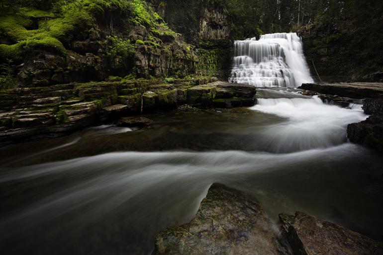
Ousel Falls is a powerful 35-foot cataract that plunges off a moss-covered rock wall onto a granite shelf in an amazing display of whitewater. The waterfall is located in 29-acre Ousel Falls Park, a short distance southwest of Big Sky Meadow Village. Ousel Falls is named after water ouzels, the small gray birds often present in the nooks next to the waterfall. The interpretive trail parallels the South Fork of the West Fork of the Gallatin River through a forested gulch with three bridge crossings. The trail leads to three separate viewing areas of the falls. Interpretive signs describe the geology, wildlife, and vegetation.
Driving Directions
From Four Corners, nine miles west of Bozeman, take Hwy. 191 south toward Gallatin Canyon. Drive 33.8 miles to Big Sky Spur Road (Highway 64) at mile marker 48. Turn right and continue 2.9 miles to Ousel Falls Road by the posted Big Sky Town Center. Turn left and continue 1.8 miles to the signed Ousel Falls Park on the left. Turn left and park.
Hiking Directions
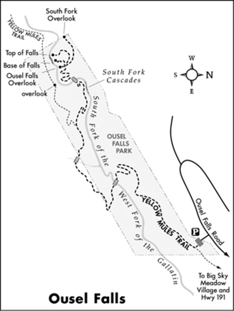
From the trailhead, the left fork leads two miles back to the town center. Take the Yellow Mules Trail to the right. Descend on the wide gravel path, and enter a Douglas fir forest. Continue on the north wall of the stream-fed canyon. Three switchbacks zigzag down to a bridge crossing over the South Fork of the West Fork of the Gallatin. Ascend the south wall of the canyon, curving up the mountain contours. Cross a bridge over a tributary stream to a posted Y-fork. The Yellow Mules Trail veers left. Curve right toward Ousel Falls. Descend to the river via two switchbacks. Across the river is a vertical rock wall with seepage dripping through the fractured rock. Walk upstream along the South Fork Cascades and the sandstone formations. Cross a bridge over the river, and climb along the north side of the waterway. Two more switchbacks lead to a four-way trail split. The right fork leads a short distance to the South Fork Overlook, with views of the river and falls from high above the river. The second trail to the right leads to the top of Ousel Falls on a natural footpath. The path straight ahead leads to a picnic area and a pool at the base of the waterfall. The left fork leads to a rock overlook of Ousel Falls. Return along the same path.
Vitals
Distance: 1.6 miles
Hiking Time: 45 minutes
Elevation Gain: 400 feet
Maps: USGS Ousel Falls
This article is excerpted from Robert Stone’s Day Hikes around Bozeman. For more info, visit dayhikebooks.com.

