North by Northwest
Three days in western Montana.
Some places are just made for playing, such as western Montana. Within its 22,000 square miles of wild terrain are blue-ribbon trout rivers, colorful cliffs, wide valleys, thousands of miles of trails, and some of the coolest towns in the West—not to mention Glacier National Park. One of the best ways to soak up this part of Big Sky Country is to roll the windows down, pop in some tunes, and hit the open road for a three-day adventure.
Day One
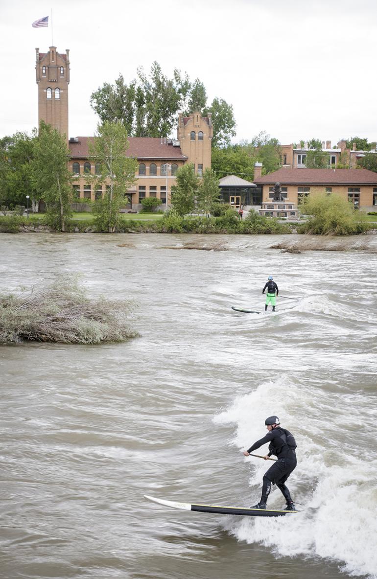
Drive west from Bozeman to Missoula, taking in views of the Tobacco Root, Highland, Pioneer, Elkhorn, Flint Creek, Garnet, and Sapphire ranges. In Missoula, stock up on any last-minute gear and essentials at the Trail Head and grab a smoothie downtown. If it’s hot, walk to Strongwater Mountain Surf (yep, surf) to rent a paddleboard. Head north to Salmon Lake for a change of scenery, or paddle Missoula’s popular “town stretch” for a few hours to beat the heat before grabbing a beer on the patio of Kettle House Brewing Company and heading out of town to find a campsite. Pitch your tent along the nearby Clark’s Fork, Bitterroot, or Blackfoot rivers, and end the day casting for trout in the perfect, sundrenched riffles that inspired Montana’s signature fly-fishing film, A River Runs Through It. Sigh with contentment before going to sleep under the stars.
Day Two
Travel north on Hwy. 93, toward the jagged, perennially snow-covered peaks of the Mission Mountains near historic St. Ignatius. For a taste of Montana, swing into the Windmill Village Bakery in Ravalli for one of the best donuts in the West. Take a short detour to Moiese and the National Bison Range, which was established in 1908, making it one of the oldest wildlife refuges in the nation. Around 400 bison share the prairie with elk, bear, pronghorn, and more than 200 species of birds. Bring binoculars!
Continue north to the crest of Polson Hill and take in views of Flathead Lake—the largest natural freshwater lake in the West. At Polson, take the road less traveled and head around the east side of the lake on Hwy. 35, stopping to pick world-famous Flathead cherries that grow in orchards facing the immense lake. Beat the summer heat by taking a swim in one of the public access points along the way.
After gorging on cherries, continue north to the small lakeside town of Whitefish, and head directly up to Whitefish Mountain Resort. There, you can spend the afternoon hiking, zip lining, or mountain biking on lift-served or cross-country terrain, all with spectacular views of Whitefish Lake and Glacier National Park. The mountain biking here is taking off, with nearly 30 miles of trails from mild to wild, and rentals are available if you forgot your ride. If the resort atmosphere isn’t what you’re after, rock climb for the afternoon at Kila or Koocanusa Lake crags. You can camp nearly within walking distance of downtown Whitefish at Whitefish Lake State Park, or find dispersed camping galore on the shores of Hungry Horse Reservoir near Columbia Falls.
Day Three
Drive east on Hwy. 2 into the quaint community of West Glacier. You’ll cross the rushing Middle Fork of the Flathead River, which has a distinct and beautiful color created by glacial runoff. Sign up for a half-day rafting trip on the Middle Fork at Glacier Raft Company, and enjoy family-friendly Class II-III whitewater under the sun. If rafting isn’t your thing, head directly into grand Glacier National Park, which famed naturalist George Bird Grinnell called “The Crown of the Continent.”
Apgar is located a mere two-minute drive from the park’s west entrance, nestled at the southern end of Lake McDonald. Dip your toes into the crystal clear waters of the Park’s largest lake, and take in the view of Glacier’s striking peaks rising more than 6,000 feet. You’ll be going over those peaks shortly.
Continue past historic Lake McDonald Lodge before cruising through a forest of ancient red cedars, steadily gaining elevation as the road curves at “The Loop.” This is Going-to-the-Sun Road, a 50-mile-long engineering marvel and National Historic Landmark. It took 12 years to build and was completed in 1932. If you get a chance to ride over Logan Pass in one of the park’s restored 1936 “Red Bus” touring cars, don’t pass it up.
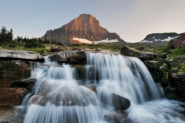
At the top of Going-to-the-Sun Road lays Logan Pass and its visitor center. Get out, stretch your legs and take a short—or long—hike in the shadow of Reynolds Mountain among wildflowers, mountain goats, and industrious ground squirrels. The hiking options are limitless, so if you have a few hours to kill, check out Hidden Lake and Bearhat Mountain, which are nearby but feel worlds apart from the tourist traffic.
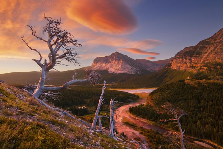
After crossing the Continental Divide, descend the east side of Going-to-the-Sun Road toward St. Mary. Watch the terrain change as you lose elevation, and keep an eye out for wildlife including grizzly bears—they’re thick in Glacier. To return to Bozeman from St. Mary, drive south on Hwy. 89 across the rolling plains of the Rocky Mountain Front—the landscape that inspired western painter Charlie Russell—as sunset falls over the peaks to the west.
Bonus Day
Rather than drive home, camp at St. Mary and take the 6:30pm boat tour on the lake. You’ll see Sexton Glacier, Wild Goose Island, waterfalls, rugged cliffs, and ancient forests from a unique perspective. The next day, get up early and drive north to Many Glacier. From the end of the road, hike 4.5 miles to spectacular Iceberg Lake. Bring your camera, as photography opportunities abound along the entire length of the trail and wildlife—including bears—is everywhere. Bring your bear spray!
Helpful Resources
Websites:
glaciermt.com
nps.gov/glac
visitmt.com
Books:
Best Easy Day Hikes – Glacier and Waterton Lakes National Parks; Erik Molver
The Ultimate Flathead Lake Vacation Guide; M. Hewston
Montana Atlas & Gazetteer; DeLorme
Fishing Glacier National Park; Russ Schneider
Pick up regional maps at local outfitters, shops, or even gas stations. Hiking, biking, and wilderness-specific maps can be useful depending on the course your trip takes and are available locally.


